![]()
InfraDoctor® is a cutting-edge system for supporting infrastructure maintenance utilizing GIS and 3D point cloud data. The system is super efficient, allowing the inspections, maintenance management, road repair and design works to be more precisely targeted.
This is also the core function of iDREAMs® which is an advanced administration system developed by Metropolitan Expressway.
What is GIS?
GIS means Geographic Information System. With geographic data, it makes data management and design a true possibility. The system can display information in various format which allows detailed analysis and effective decision.
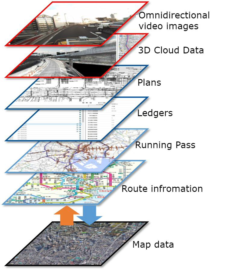
The following image shows different formats that InfraDoctor can render using the GIS platform.
The following image shows different formats that InfraDoctor can render using the GIS platform.
What is point cloud?
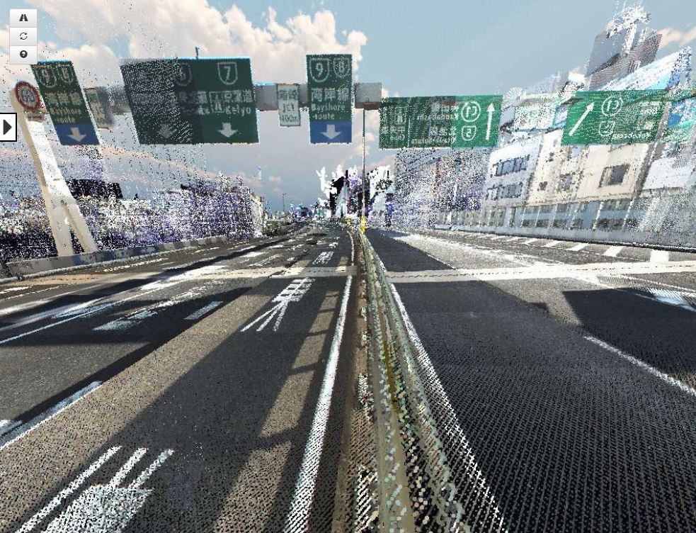
Point Cloud data is similar to the art technique 'Pointillism', in which small, distinct dots of colour are applied in patterns to form an image.
These points are gathered by laser scanners. Each point has reflections levels, coordinates in space (x, y, z) and RGB colour data.
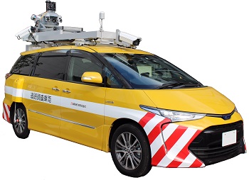
For InfraDoctor system, 3D point cloud data is acquired by the Mobile Mapping System (MMS) and fixed typed laser scanners.
These points are gathered by laser scanners. Each point has reflections levels, coordinates in space (x, y, z) and RGB colour data.
For InfraDoctor system, 3D point cloud data is acquired by the Mobile Mapping System (MMS) and fixed typed laser scanners.
Mobile Mapping System (MMS) vehicle
MMS vehicle is equipped with laser scanners and all around panoramic cameras. For locations where MMS vehicle cannot obtain scanned data, for example under certain elevated structures or road side zones, a fixed type laser scanner is used.
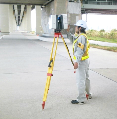
Fixed type laser scanner
In the place which are not able to through by MMS, we use fixed type laser scanners for supplemental scanning.