![]()
InfraDoctor® is a cutting-edge system for supporting infrastructure maintenance utilizing GIS and 3D point cloud data. The system is super efficient, allowing the inspections, maintenance management, road repair and design works to be more precisely targeted.
This is also the core function of iDREAMs® which is an advanced administration system developed by Metropolitan Expressway.
CIM
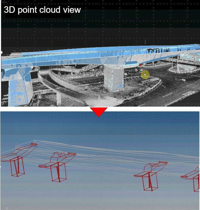
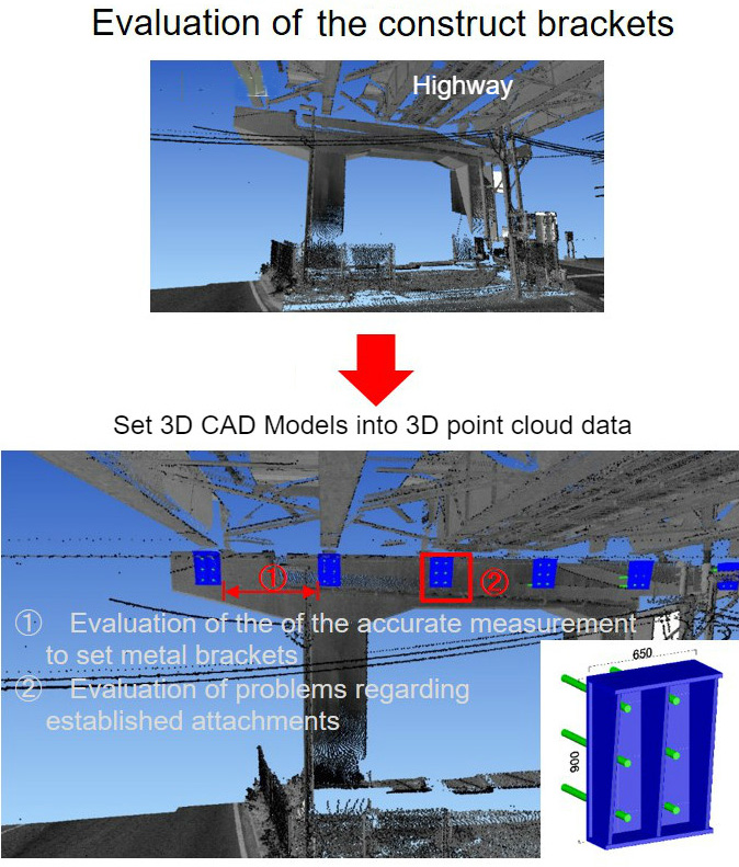
Images below are examples of measurements and simulation gathered by 3D point cloud data.
*Avairable category depends on the laser point numbers.
Requirement: MMS speed, under 60km per hour; distance between laser and structure, under 5m
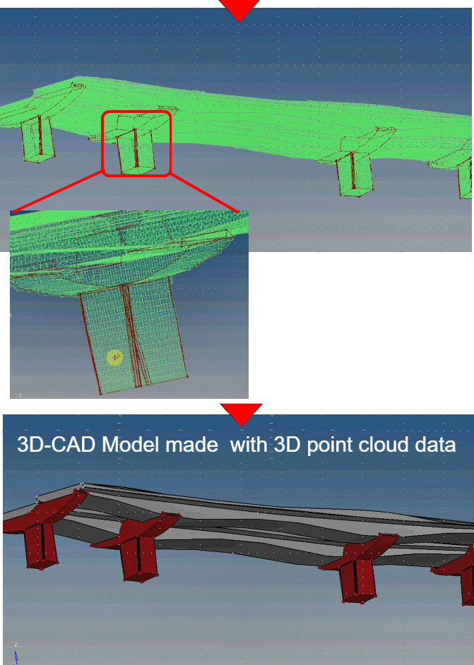
Images below are examples of measurements and simulation gathered by 3D point cloud data.
Effective management of infrastructure products
Requirement laser level; over one million points
With DIM and CIM
Requirement laser level; over one million points
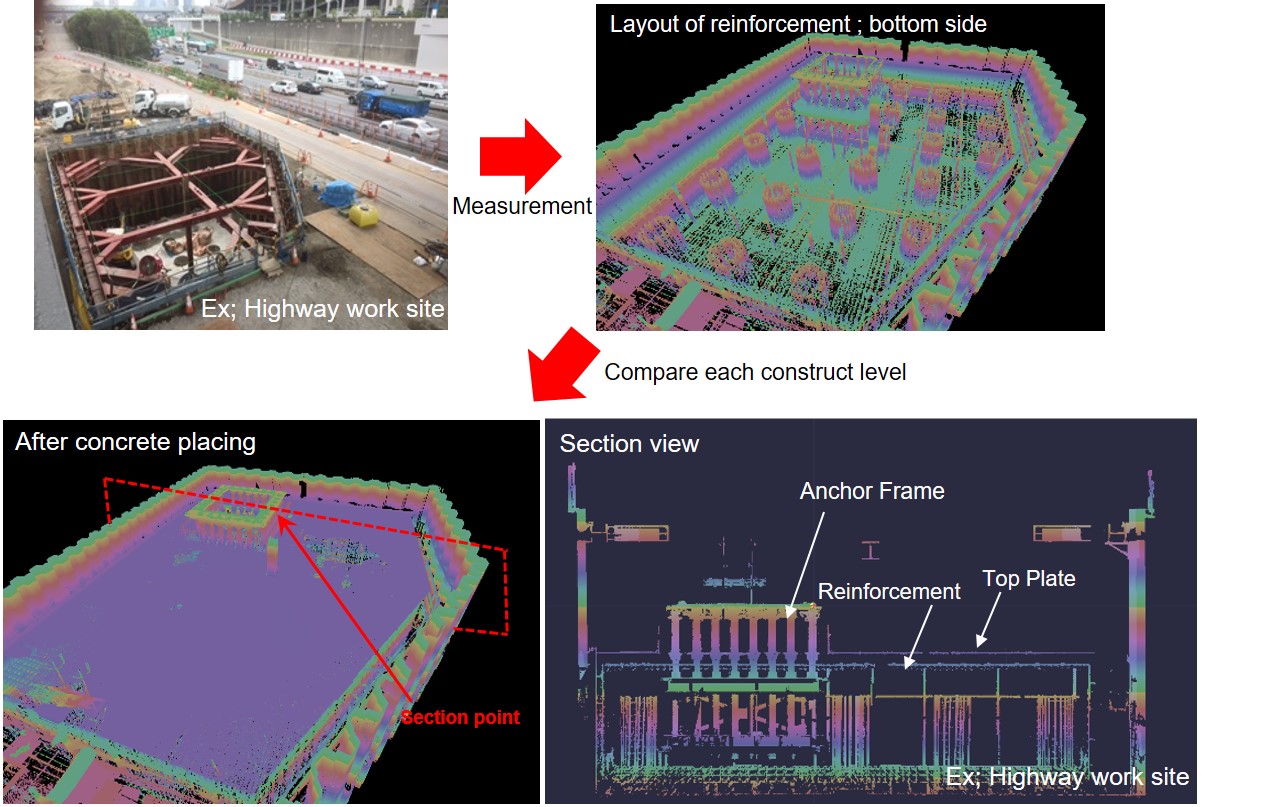
During construction; Effective inspection of reinforced steel rods utilizing 3D point cloud data.
After construction; when a repair work is needed, the details of reinforced steel rods can be viewed using 3D point cloud data.
Examination of installation of infrastructure
Requirement laser level; over one million points
3D CAD models
Requirement laser level; over one million points