![]()
InfraDoctor® is a cutting-edge system for supporting infrastructure maintenance utilizing GIS and 3D point cloud data. The system is super efficient, allowing the inspections, maintenance management, road repair and design works to be more precisely targeted.
This is also the core function of iDREAMs® which is an advanced administration system developed by Metropolitan Expressway.
Measurement Work and Simulation
Examples of measurement and simulation using 3D point cloud data. InfraDoctor allows effective working practice far better than before.
*Avairable category depends on the laser point numbers.
Requirement: MMS speed, under 60km per hour; distance between laser and structure, under 5m
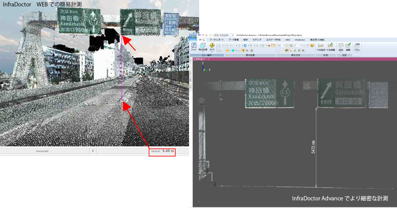
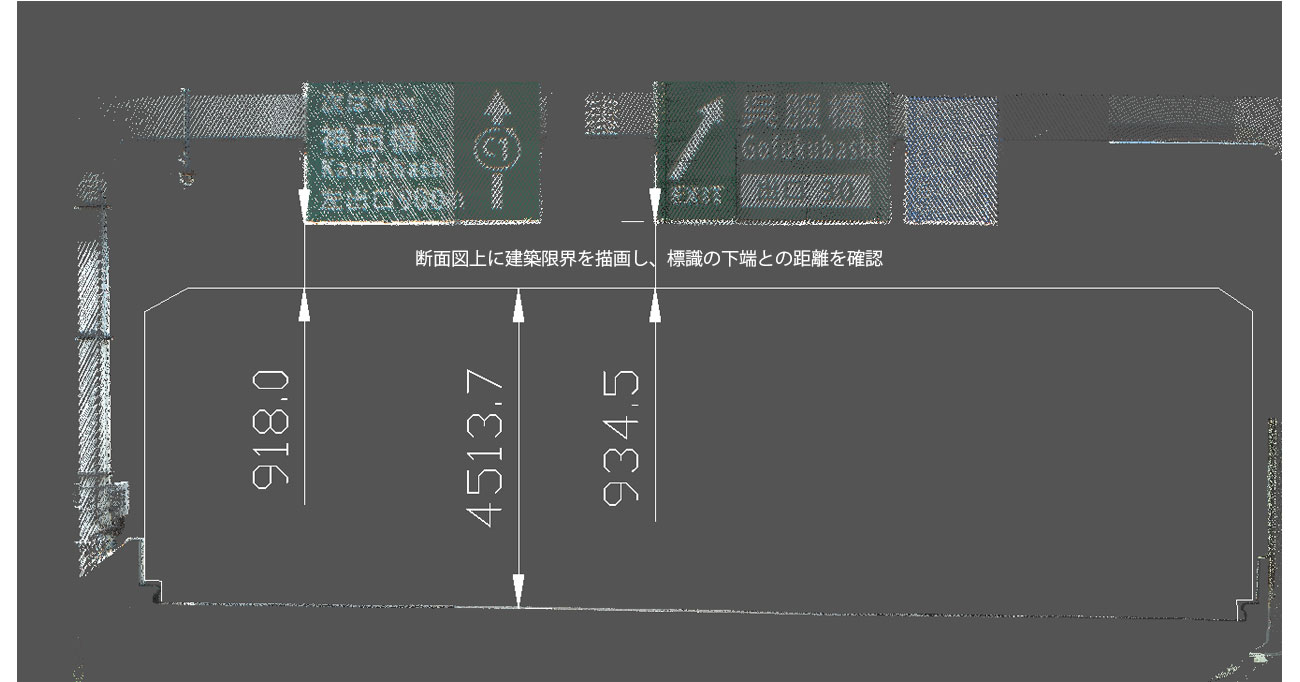
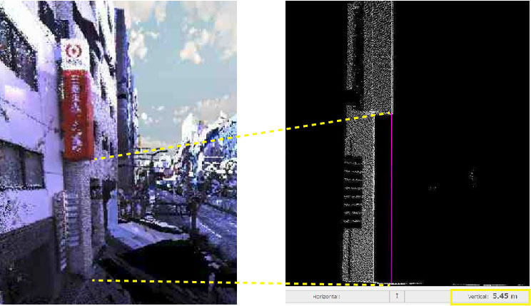
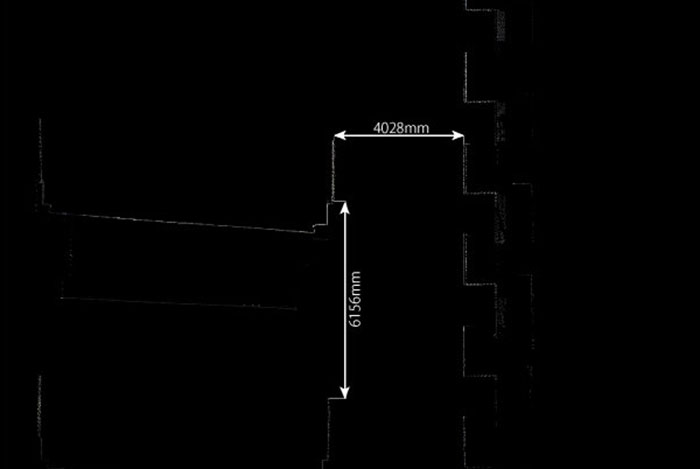
3D dimension measurement
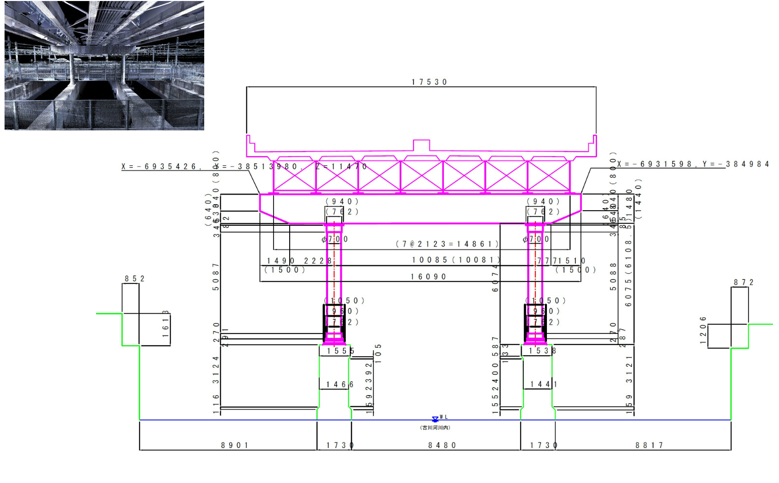
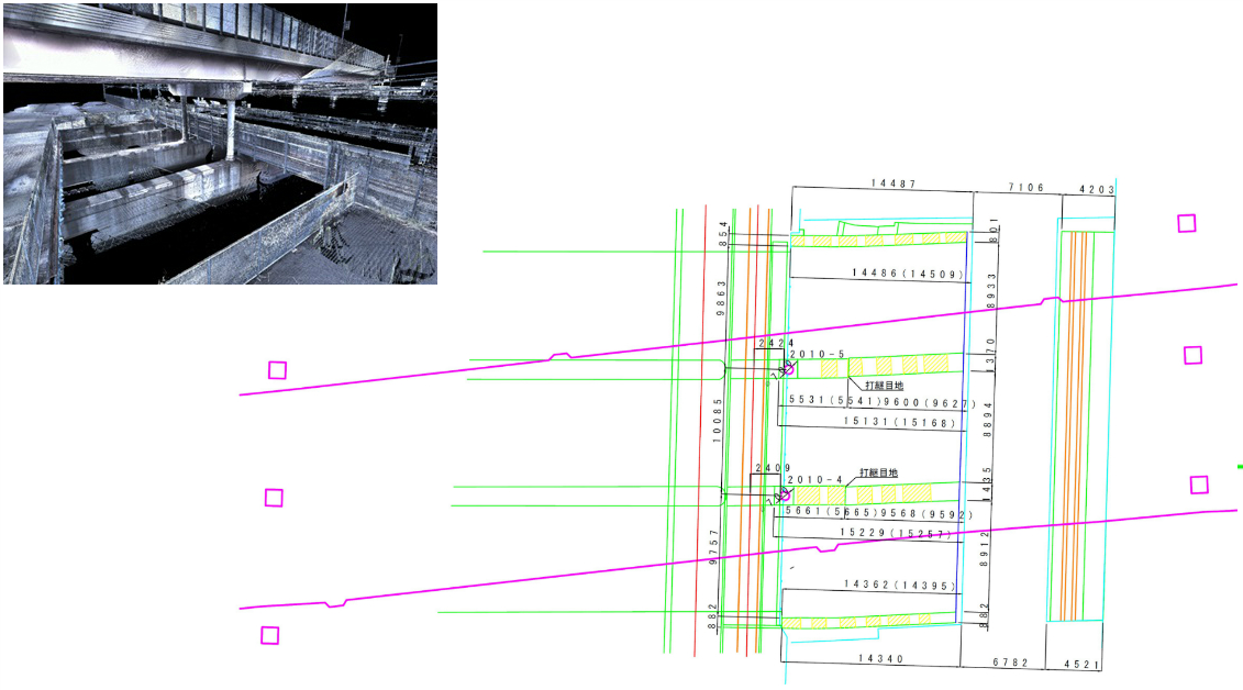
Drawing plans utilizing 3D point cloud data
Requirement laser level; Drawing Plans ≫ over one million points / Drawing cross sections and longitudinal sections ≫ over 50 thousand points
You can draw a plane plan by extracting contours from 3D point cloud data on InfraDoctor ADVANCE.
*To finalize, manual operation is needed using CAD
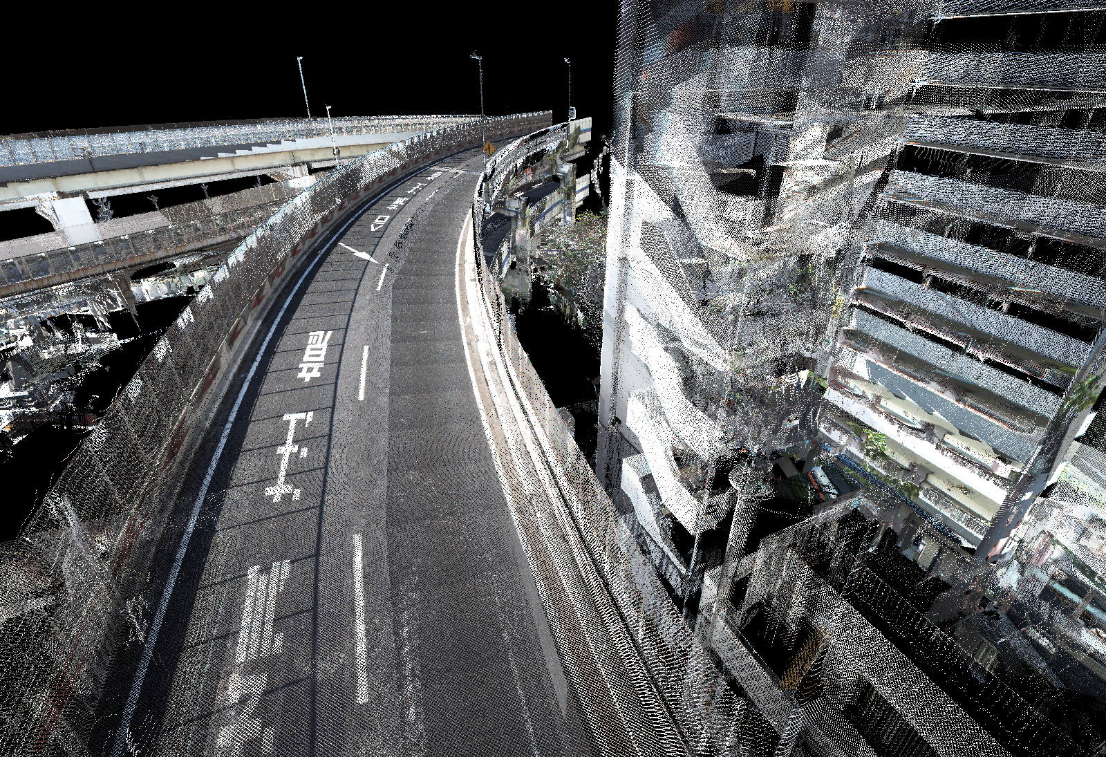
Comfirming separations
Requirement laser level; over 500 thousand points
You can confirm separations between neighbouring structures using 3D pint data in your office without the needs of visiting the site.
Special vehicle passing through and work vehicles simulation
Requirement laser level; over one million points
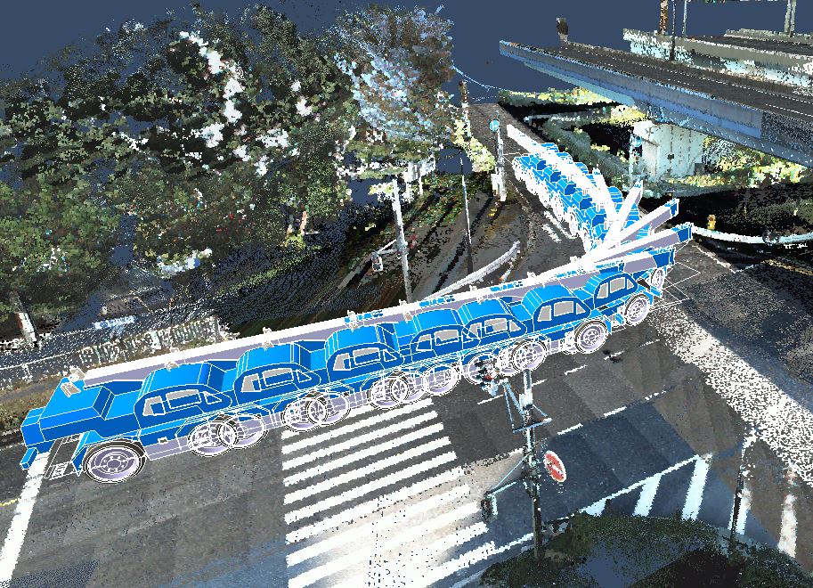
Clients can provide any 3D vehicle models to be included in the InfraDoctor (additional cost applied). Thus, you can simulate various work vehicles weather can be available on the work site. This function supports you to make effective preparing.
Driving safety simulation
Requirement laser level; over 300 thousand points
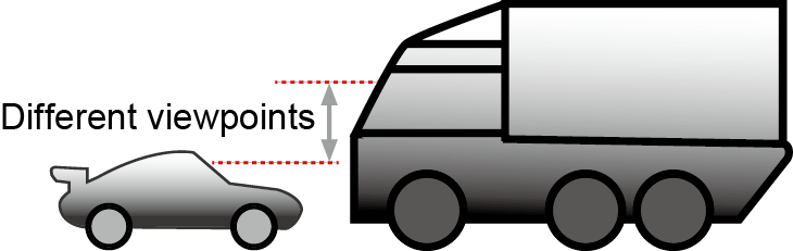
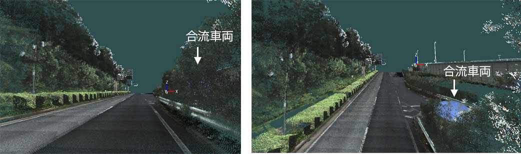
The image on the left shows a low driving position view. The image on the right shows a high driving position view, in which a car can be seen in the merging lane.
Work vehicle simulation
Requirement laser level; over one million points
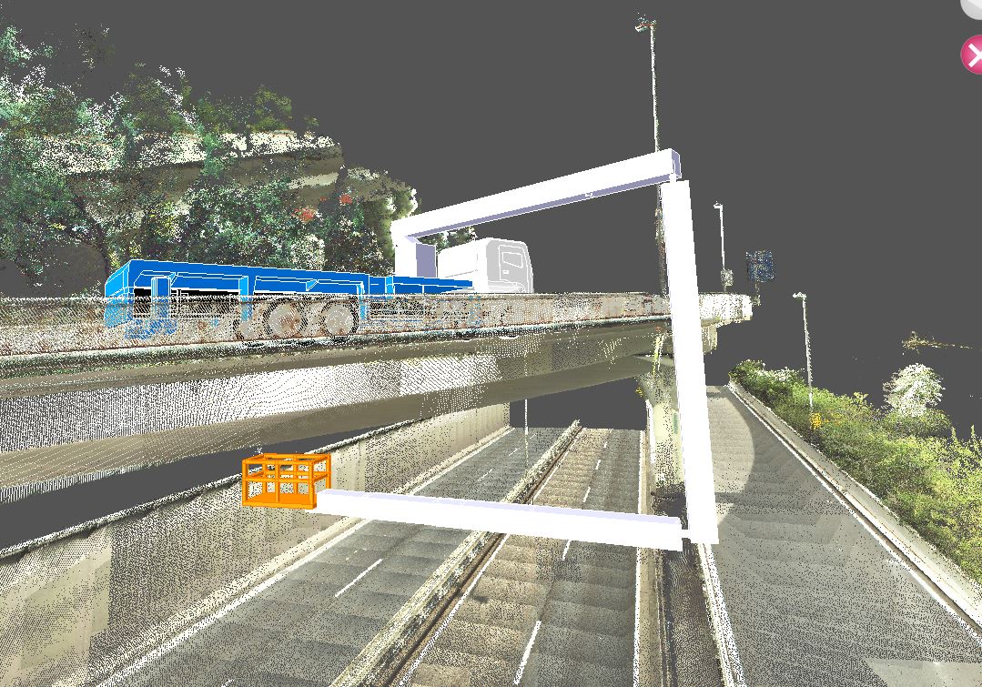
Avairable file types : stl, igs, iges, stp, step, obj,wrl, wrz, vrml, enf, enf_*, drx, drx_*