![]()
InfraDoctor® is a cutting-edge system for supporting infrastructure maintenance utilizing GIS and 3D point cloud data. The system is super efficient, allowing the inspections, maintenance management, road repair and design works to be more precisely targeted.
This is also the core function of iDREAMs® which is an advanced administration system developed by Metropolitan Expressway.
Disaster Prevention and Reduction
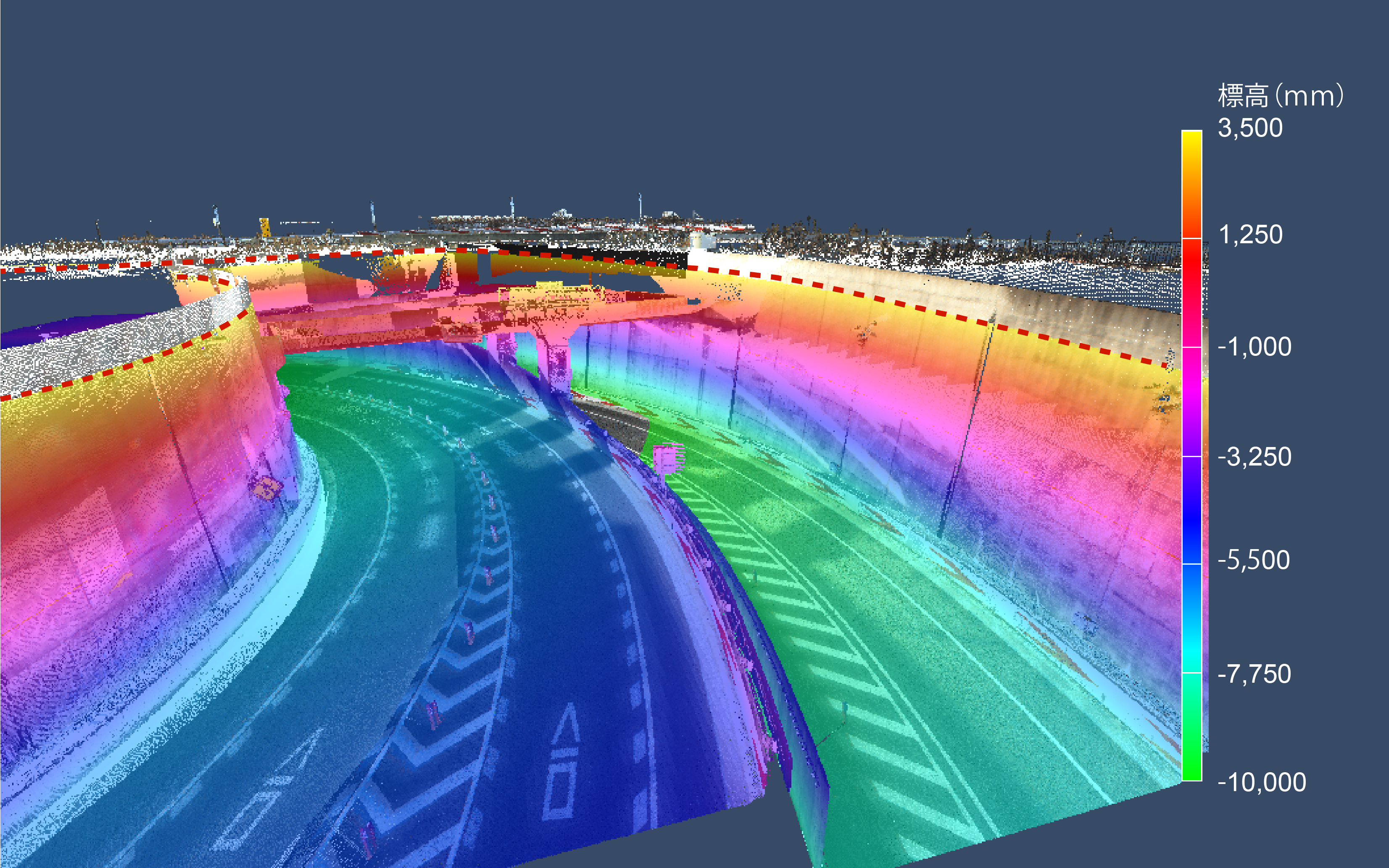
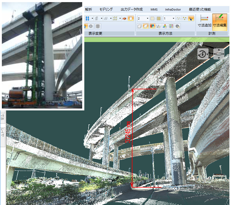
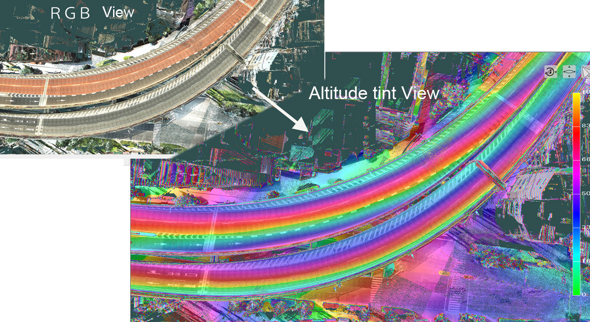
Images below are examples of measurements and simulation gathered by 3D point cloud data.
*Avairable category depends on the laser point numbers.
Requirement: MMS speed, under 60km per hour; distance between laser and structure, under 5m
Consideration of the bent height for disaster bridge
Requirement laser level; over 300 thousand points
Road drainage inspection
Requirement laser level; over 500 thousand points
Making a disaster prevention manual for Tsunami or Flood
Requirement laser level; over 500 thousand points